Capitol - Blvd - Summers - Laidley - Virginia Blocks 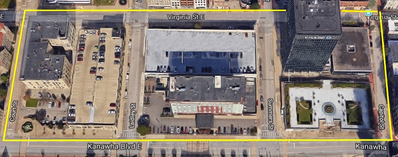
The
photos you are about to see were taken in 1961 just before the
demolition of all the buildings in the area marked off in the map
above. This was Charlestons first major Urban Renewal project to
revitalize the downtown area. This part of town was THE main
shopping area of Charleston since the beginning of the city.
As the
town expanded, and more businesses needed space, they started to
develop on Capitol Street all the way to Washington Street. Then
Quarrier Street started to fill in. Now, these very old buildings
bounded by the map above were firetraps and the decision was to remove
them and build a bank and hotel in their place.
|
PART 1
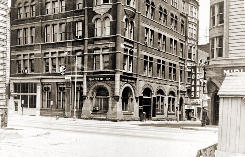
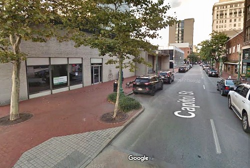
Starting
at the corner of Capitol & Kanawha Blvd, we see what was once the
Kanawha Valley Bank building built in 1894. This was the 3rd KVB
building. The 4th was built next to the Diamond Dept. Store on Capitol
Street.
____________________________________ 
|
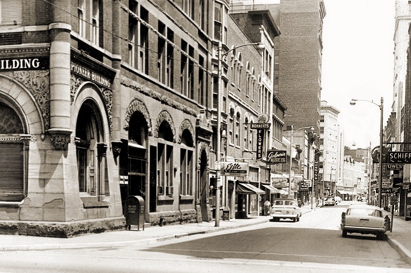
Now we're looking down Capitol Street. Let's take a closer look at those stores.
____________________________________
|
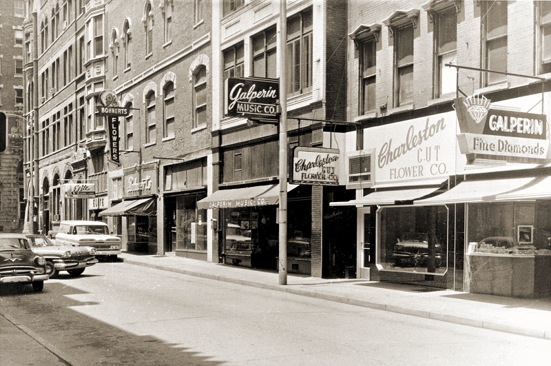
Galperin
was a big name in Charleston, both in jewelry and music. Most
high school kids got their instruments at Galperins. Notice two
flower shops: Charleston Cut Flower and Bohnerts.
____________________________________ 
|
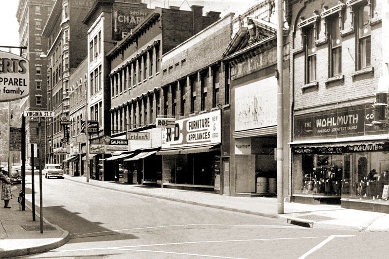
Going further down the block we reach Virginia Street.
|
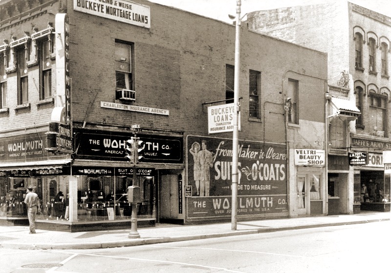
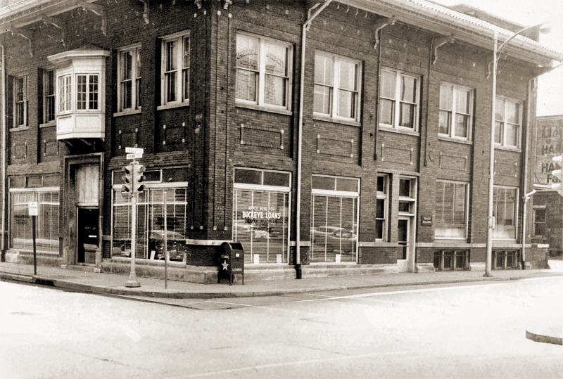
As
we turn the corner on Virginia Street, we see Wohlmuth's clothing
store, Veltri's Beauty Shop, Totten Jewelers, Buckeye Loans, and
Jaffes Army Navy Store.
__________________________________
|
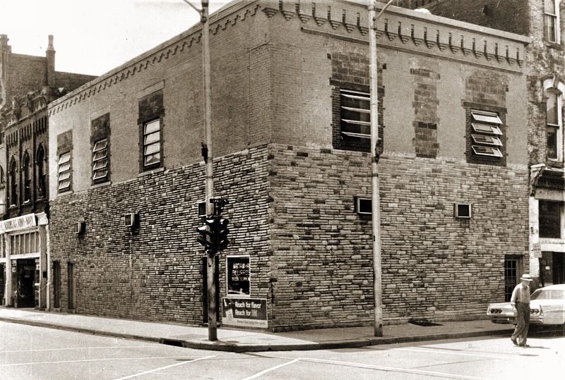
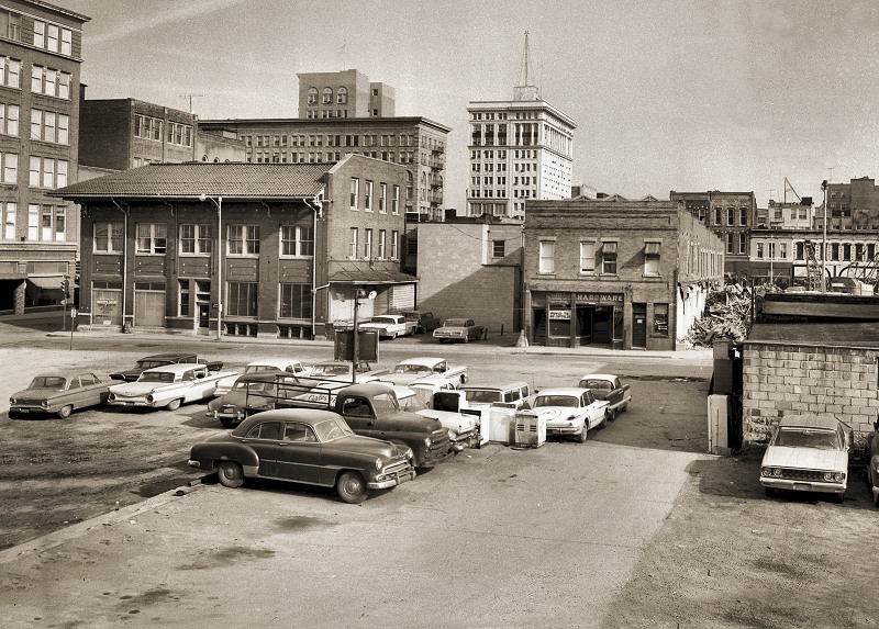
 This is the middle of the block of Virginia Street between Capitol and Summers.
Many buildings have already been removed to open this section up for the KB&T parking lot.
__________________________________
|
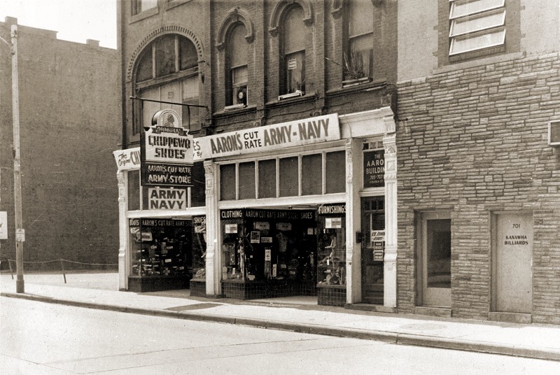
Now we scoot down the middle of the block and see Aaron's Army Navy Store and Kan Billiards.
At this point, we are just feet away from Summers Street.
______________________________________
|
Here were are on the corner of Virginia and Summers Street. We'll look south on the next picture.
_________________________________
|
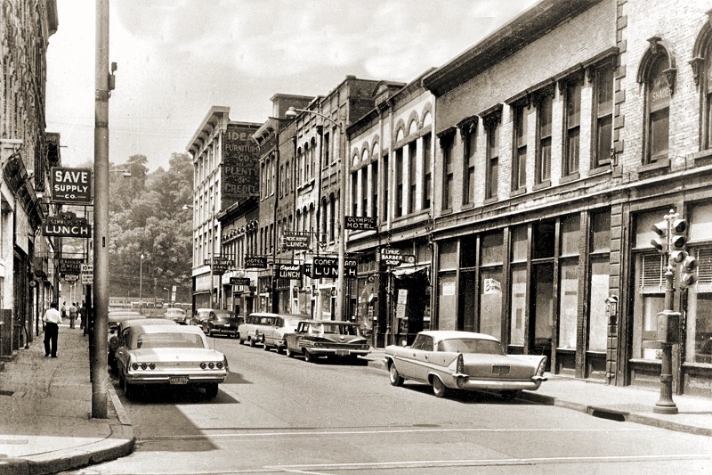
Looking
South on Summers Street towards the Blvd. On the left is Save
Supply, the Summers St Lunch, and Kessler's Jewelery.
On the right is the Lyric Barber Shop, Olympic Hotel, Coney
Island Lunch, Crystal Lunch, Blue Ridge Lunch, Edwards
Hotel, Manhattan Hotel, and Uncle Jakes Loans.
_________________________________________
|
 Going West one block on Virginia Street between Summers and Laidley.
____________________________________
|
Corner
of Laidley and Virginia Street. This for many years was the
Charleston Urban Railroad station. (Trolly)It also serviced the Blue
& Gray bus line and then the Greyhound Line.
|
| Same
building looking across the street from City Hall. The store that
says "Hardware" was the Dan J. Popp's harness shop, which had been in
business since the turn of the century. He moved near me at 610 Capitol
Street, and had a full size horse replica outside. |
GO TO NEXT PAGE TO COMPLETE THE TOUR.

Back to Index
|